11 FREE TRAVEL DESTINATION IN JAKARTA

Free tours in Jakarta that are comfortable and enjoyable for those of you who want to vacation around the city of Jakarta

BANYU TIBO BEACH, PACITAN

Banyu Tibo Beach is a beach tourism object that presents quite beautiful natural panoramas that are rarely found on beaches in Indonesia.

Pindul Gunung Kidul Cave Nature Tourism

Enjoy Nature with Cave Tubing

INDRAYANTI BEACH GUNUNGKIDUL

Jogja Beach Tourism with Balinese Nuances

NAMPU BEACH

Nampu Beach, Exotic Wonogiri Beach Tourism

HISTORY OF MATHEMATICS

The branch of study known as the history of mathematics is the investigation of the origins of discoveries in mathematics and, to a lesser extent, the investigation of the methods and notation of mathematics in the past

HISTORY OF MOUNT KRAKATAU IN INDONESIA

In the beginning, the big island of Krakatau, which we usually call by the name of Mount Krakatau, was a mountain (ancient Mount Krakatau) which has a height of about 2000 meters above sea level with a circle of beaches of about 11 km and a radius of about 9 km2.

Tuesday, September 30, 2014

Ngobaran Beach, a beach with a million beauties

Ngobaran Beach, a beach with a million beauties

Ngobaran Beach Tourism Object - Ngobaran Beach is one of the beaches among several beaches in Gunungkidul Regency which has quite a charming natural charm with white sand combined with lined coral rocks and seaweed or algae that grows in the beach area when sea water is receding so that it adds a unique impression to Ngobaran beach tourism.

Ngobaran Beach, a beach with a million beauties

In addition to keeping the charm of nature that is still a virgin, this beach which is located in Kanigoro Village, Saptosari District, Gunungkidul Regency, about 65 kilometers from Yogyakarta City, also has its own uniqueness which is the hallmark of this beach, namely the existence of a temple at the end of a rock, similar to a like the temples on the island of Bali, inside the temple there are many statues of gods, besides that visitors can also see firsthand the beauty of the open sea which is so enchanting from this temple.

The name Ngobaran comes from the history of Prabu Brawijaya V who was the last king of the Majapahit Kingdom, which at the same time the Islamic Kingdom developed rapidly with the establishment of Islamic kingdoms on the north coast of Java Island in the mid-15th century AD. The fact that one of the sons of King Brawijaya V, namely Raden Patah was the ruler of the kingdom of Demak I, a kingdom on the north coast. The development of Islam on the island of Java was very rapid, until it touched the center of the Majapahit kingdom and then the Majapahit kingdom could no longer be maintained. King Brawijaya V and one of his sons, Bondan Kejawan, left the Majapahit kingdom, walked west and arrived at a very peaceful place, where King Brawijaya V and his son lived. According to sources I have read, the Prabu took this step, namely to carry out the muksa ceremony because he did not want to fight against his own son, Raden Patah (King I Demak). However, the truth of the story about Brawijaya V is now being doubted by many historians. The King is believed to perform the muksa ceremony by setting himself on fire. The flames from the muksa ceremony are what make this beach the name Ngobaran.

Access to Ngobaran Beach Tourism
To get to the location of Ngobaran Beach is not too difficult because there is already a signboard, but visitors are expected to be careful because the road to Nini Beach is quite narrow and winding and up and down. If you are coming from the Jogja-Wonosari road at the Gading junction, please take the road south towards Playen, just follow the road until you reach the Paliyan market junction, take a left, then not far from there, turn right and just follow the road and the signposts to Ngobaran beach.

Monday, September 29, 2014

Enjoying the Beauty of Nature Above Suroloyo Peak

Enjoying the Beauty of Nature Above Suroloyo Peak
Suroloyo Peak is the highest peak in the Menoreh Hills, Yogyakarta with a height of approximately 2000 meters above sea level which stretches across Yogyakarta and Central Java. At Suroloyo Peak, besides being able to enjoy the natural beauty around the hills, on this hill you can see the city of Yogyakarta and see firsthand the beauty of Borobudur Temple.

At the Suroloyo Peak Tourism Object, there are also three viewing posts which are generally called the hermitage, each of which has a name, namely Suroloyo, Sariloyo, and Kaendran. In addition, Suroloyo Hill is also a place that holds legends. This legend tells of a Raden Mas Rangsang who later had the title of Sultan Agung Hanyokrokusumo, imprisoned to carry out the wangsit that came to him.

The Legend of Suroloyo Peak
The legend about Puncak Suroloyo comes from a poet named Ngabehi Yasadipura from the Surakarta Palace, whose book is entitled Cabolek. He recounted that Raden Mas Rangsang, the Crown Prince of the Islamic Mataram Kingdom, had received a wangsit to become the ruler of the land of Java. Raden Mas Rangsang had to walk from the palace in the Kotagede area to the west. After traveling about 40 kilometers in the Menoreh Mountains region, he fainted from exhaustion. In his stupor, Raden Mas Rangsang received a second wangsit. The Wangsit ordered Raden Mas Rangsang, who had the title of Sultan Agung Hanyakrakusuma when he was growing up, to perform tapa cesarian in that place. That place is now called Suroloyo Peak.

Suroloyo Peak Tour
There are three pavilions at Suroloyo Peak. The first pavilion is Suroloyo Hermitage which is located at the bottom compared to the other two pavilions, from this pavilion visitors can see the beauty of Borobudur Temple. The second pavilion named Sariloyo Hermitage is located 200 meters to the west. From Sariloyo Hermitage, visitors can enjoy the beauty of Mount Sumbing and Mount Sindoro. To reach the third pavilion, visitors must climb the stairs about 200 meters again. This pavilion is named Kaendran Hermitage. From this place, you can vaguely see the blue border with gray which is Glagah Beach in Kulonprogo. All of these hermitages are in one contiguous area in the Suroloyo Peak area. Suroloyo Peak is a meeting point between four mountains, namely: Merapi, Sindoro, Sumbing, and Merbabu.

Access to Suroloyo Peak
To get to the Suroloyo Peak Tourism area, there are two routes that you can choose from before heading to Suroloyo Peak, the first is the Godean - Sentolo - Kalibawang route while the second route is via Magelang - Muntilan Market - Kalibawang. To reach the top of Suroloyo, you have to go through a journey that goes up and down with sharp turns and steep inclines. The road to Suroloyo Peak is passable by motorbike, but for cars, you have to be careful because the road is 3 meters wide. If you have passed the narrow winding road, the path that needs to be taken is the stairs leading to Suroloyo Peak. To reach Suroloyo Peak, you have to pass as many as 290 steps. ( From various sources )

Wediombo Beach tourism object South Mountain

Wediombo Beach tourism object South Mountain

Wediombo Beach is one of the beach resorts located in  South Mountain Regency, Yogyakarta which offers quite enchanting natural beauty with a fairly wide stretch of white sand combined with unique clusters of rocks.

Apart from offering the beauty of its pristine beaches, the beach which is located in Jepitu Village, Girisubo District, approximately 40 km from the city of Wonosari also has waves that are big enough so it is perfect for visitors who like surfing, addition to those who like fishing, in the area On the beach there is a rock that juts into the sea which can be used as a place for fishing.

Wediombo Beach tourism object South Mountain

Wediombo Beach also has its own features compared to the beaches in the South Mountain district, namely the many shady trees that grow around the beach so that this beach looks cooler and more pleasant.

Meanwhile, the facilities at the Wediombo Beach Tourism Object are quite adequate, with parking lots, bathrooms with clean water, and stalls providing food and drinks. The difference is that with other beaches in South Mountain, there are no fishing boats here. But many residents around fishing around the beach.

Sunday, September 28, 2014

Ngrenehan Beach Hidden Paradise


Ngrenehan Beach, Hidden Paradise

Ngrenehan Beach Tourism Object, South Mountain - Ngrenehan Beach is one of the beach tourism objects located in the South Mountain Regency, precisely in Kanigoro Village, Saptosari District, approximately 30 km south of Wonosari.

Ngrenehan Beach is a fishing beach that offers enchanting natural beauty with white sand surrounded by limestone hills with crashing waves that sweep across the shoreline which adds to the exotic impression. The existence of the hidden Ngrenehan Beach Tourism makes this beach not widely known by tourists, because to reach this beach you have to go through a narrow and winding road, besides that there is no transportation to the beach location.

Ngrenehan Beach, Hidden Paradise

Apart from offering quite a stunning view, at Ngrenehan Beach, you can also enjoy seafood dishes, because on this beach there is also a fish auction, the same as on Depok Beach, Bantul, Yogyakarta. Besides being able to buy fresh seafood directly, you can also enjoy processed seafood dishes available in stalls around the beach.

Access to Ngrenehan Beach
To get to the Ngrenehan Beach location, visitors can follow the signs to Ngrenehan Beach. Past the Namberan Trowono spring, then continue on to Kanigoro, Saptosari then there is a T-junction with a signpost to the right of Ngobaran Beach, and to the left of Ngrenehan Beach.

Friday, September 26, 2014

Exotic Lake Segara Child Natural Tourism

Exotic Lake Segara Child Natural Tourism

Segara Child Nature Tourism Object, Lombok - Segara Child is a crater lake located in the valley on the west side of Mount Rinjani which is geographically located in Sembalun Lawang Village, Sembalun District, East Lombok Regency, Lombok Island, West Nusa Tenggara. The name Segara Child means child of the sea which is believed to be part of the sea and is divided into an island.

Segara Child Lake is located at an altitude of approximately 2000 meters above sea level. If you climb Mount Rinjani (3726 masl), generally the Tour Guide will take you across this lake and spend the night there.

There are many interesting things to do on this lake, besides being able to enjoy the beautiful natural scenery, Segara Child Lake also has lots of fish ranging from tilapia, carp, and tilapia. These fish are deliberately bred by the government and local people to add to the attractiveness of Lake Segara Child Don't forget to prepare fishing equipment for those of you who are interested in climbing Mount Rinjani.

Exotic Lake Segara Child Natural Tourism

Many climbers of Mount Rinjani make hiking trails along the valley beside the lake to make offerings to the gods at the bottom of the lake. From the lake, you can see a volcano (Gunung Baru Jari which means new mountain) which is a subsidiary of Mount Rinjani, and nearby is a source of hot air which is believed to be able to treat various skin diseases.

At the campsite near Lake Segara Child, there is an old tree that is sacred to the locals. With the intermediary of this tree, it is believed that what we wish for can come true. The myth that has developed in the local community is that if you have a wish that has not been granted, hang a stone on this tree and then say your wish. If your wish is achieved, then the stone that you hung before must be removed immediately. According to the local people, if you don't return the stone, the desire you have achieved will return to nothing.

The scenery on this lake is truly amazing and so beautiful that many foreign and domestic tourists come and climb Mount Rinjani to witness the beauty of the lake. Lake Segara Child covers 1,100 ha with a depth of 230 m.

Access to Lake Segara Child
There are several paths known as the Lake Segara Anakan hiking trail and the summit of Rinjani. First, the Sembalun Route; This route is pretty much chosen by tourists and climbers. The Sembalun route is as follows: Mataram–Sembalun–Sembalun Lawang–Segara Child Lake.

The distance from Mataram to Sembalun is a 4-5 hour drive. You can rent a car to get directly to Sembalun. However, if you choose to take public transportation, you will have to change cars twice. From Mataram, take public transportation to Aikmel; the journey then continues from Aikmel to Sembalun with other public transportation. Instead, you go early if you use public transportation because the Aikmel–Sembalun transport only operates until 12 noon.

This route is dominated by savanna because this path is rather hot due to exposure to the hot sun in the open fields. Even so, this path still presents beautiful natural scenery and is not too steep when compared to the Senaru route.

Second, the Senaru Line: Mataram–Senaru–Lake Segara Child–Pelawangan Sembalun–Top of Rinjani.
From the Mandalika Terminal in Mataram, the trip to Senaru can be reached by public or rented transportation for 3-4 hours. From Senaru to Lake Segara Saplings can be reached on foot for 7-10 hours. If you want to get to the top of Rinjani, to reach the next point, namely Pelawangan Sembalun, the trip takes 4 hours. From there, the journey to the top can be reached for 2-3 hours on foot.

The Senaru route is one of the most chosen by visitors. This path is also a hiking trail that is also commonly taken by the people of Lombok when they want to hold religious and cultural ceremonies at Lake Segara Child.

Unlike the Sembalun Route, which is dominated by savanna, the Senaru Route is a path through the wilderness and passes through a path with rocks. But you don't need to worry, this rocky path is equipped with a safety rope for you to hold. In addition, there are three posts as a means of resting before arriving at the lake. If you want to reach the top of Mount Rinjani, the journey continues for 4-5 hours on foot.

Third, the Torean Route: Mataram–Torean–Segara Child Lake. Mataram to Torean is approximately a 4-5 hour drive. From Torean, the journey to Lake Segara Anak can be reached on foot for 8-9 hours. Unlike the two previous routes, this route offers views of rivers, farm fields, plantations, production forests, and pastures, and the opportunity to observe the animals and plants typical of the area.

Tuesday, September 23, 2014

Kuta Beach Lombok, a beach with a million beauties

Kuta Beach Lombok, a beach with a million beauties

Kuta Lombok Beach Tourism Object - Kuta Lombok Beach is a beach tourism object located on Lombok Island, West Nusa Tenggara to be precise in the village of Kuta, Central Lombok. This beach, which has quite a beautiful natural charm, looks unspoiled with white sand that stretches wide, surrounded by hills that look green, combined with waves that are calm enough to provide a pleasant atmosphere for visitors.

Kuta Beach is starting to become an attractive and mandatory tourist destination to visit on the island of Lombok. Apart from the natural beauty that can be enjoyed by this beach, once a year a Sasak ceremony is held in this village, the Bau Nyale ceremony. In this nyale smell, the sailors look for Nyale worms in the sea. According to legend, there used to be a princess, named Princess Mandalika, who was very beautiful, and many princes and youths wanted to marry her. Because he could not make up his mind, he plunged into the sea. He previously promised that he would come back once a year. Her long hair then becomes the Nyale worm.

Access to Kuta Beach Lombok Attractions
To get to the Kuta Beach Lombok Tourism Object, if you are from Lombok Praya International Airport the distance to Kuta Lombok beach is about half an hour. You will pass through Sade Tourism Village which is famous for its weaving crafts. If you are from Selaparang Airport which is located in Mataram City, using a rental car which will take around 1.5 hours to 2 hours.

The exoticism of Curug Dago Waterfall Bandung

The exoticism of Curug Dago Waterfall Bandung
The exoticism of Curug Dago Waterfall Bandung - Natural Tourism Object of Curug Dago which is located in Dago Village, Coblong District, Bandung City, West Java Province has a water level of about 12 m which is at an altitude of 800 m above sea level, the natural panorama presented on the tour This is a waterfall formed from the Cikapundung river, which is quite interesting to enjoy.

The existence of Curug Dago Nature Tourism is indeed not very well known in the city of Bandung, because of its quite hidden location which is located in the Bukit Dago area which is included in the Ir Djuanda Forest Park (THR) area, Bandung, in addition to the lack of other supporting facilities, such as promotions from the government Bandung has made Curug Dago Waterfall Natural Tourism less and fewer visitors.

The exoticism of Curug Dago Waterfall Bandung

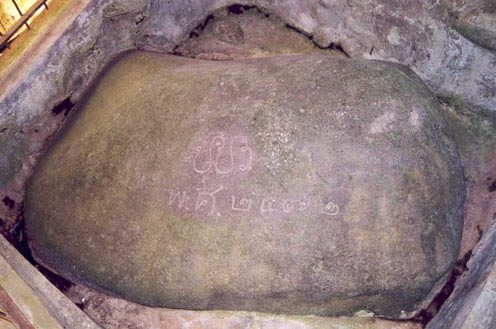
Even so, Curug Dago apparently keeps traces of history, namely by the existence of two slate inscriptions left by the Thai kingdom that visited this place in 1818. The two inscriptions are said to be the remains of King Rama V (King Chulalonkorn) and King Rama VII (Pradjathipok Pharaminthara) of the Chakri dynasty.

Access to Curug Dago Tourism
To get to the Curug Dago Waterfall Natural Tourism Object, there are two alternative roads that can be taken, namely through the road opposite the Dago terminal or through the Ganesha Dago Cultural Park (Dago Tea House) on Jl, Ir. Djuanda. The two alternative roads can only be traversed by two-wheeled vehicles or on foot.

And if you take the route from Dago Terminal, enter the footpath measuring one meter after taking about half a kilometer from the main road. The condition of the road has been concreted neatly enough so that it feels comfortable to pass. for those who bring their own vehicles can be parked in the cultural Park parking lot and then pass through the path with a fairly steep staircase.

Mount Bromo Tourism, East Java

Mount Bromo Tourism, East Java
Mount Bromo Nature Tourism Object - Mount Bromo is one of the most famous natural tourist objects in the East Java region with its exotic natural charm. Mount Bromo has an altitude of 2,392 meters above sea level and is located in four districts, namely Probolinggo, Pasuruan, Lumajang, and Malang Regencies. Mount Bromo Tourism is part of the Bromo Tengger Semeru National Park which was inaugurated by the government in 1997.

The natural condition of Mount Bromo which has valleys, canyons, calderas, or seas of sand with an area of ​​about 10 Km is the main attraction in Mount Bromo Tourism Object. In addition, in the Mount Bromo area, there is also a crater with a diameter of about 800 meters that stretches from the north to the south, and 600 meters from east to west. While the danger area is a circle with a radius of 4 km from the center of the Bromo crater.
Mount Bromo Tourism, East Java
As an active volcano, Mount Bromo has experienced eruptions at regular intervals in the past 20 centuries, which is about once every 30 years. The biggest eruption occurred in 1974 and erupted again in 2010.

History of Bromo eruptions: 2011, 2010, 2004, 2001, 1995, 1984, 1983, 1980, 1972, 1956, 1955, 1950, 1948, 1940, 1939, 1935, 1930, 1929, 1928, 191, 1922, 1922, 1928 1910, 1909, 1907, 1908, 1907, 1906, 1907, 1896, 1893, 1890, 1888, 1886, 1887, 1886, 1885, 1886, 1885, 1877, 1867, 1868, 1866, 1865, 1865, 1860, 1859, 1859. 1858, 1858, 1857, 1856, 1844, 1843, 1843, 1835, 1830, 1830, 1829, 1825, 1822, 1823, 1820, 1815, 1804, 1775, and 1767.

Mount Bromo is a holy mountain
For residents of Bromo, the Tengger tribe, Mount Brahma (Bromo) is believed to be a holy mountain. Once a year the people of Tengger hold the Yadnya Kasada or Kasodo ceremony. This ceremony takes place in a temple that is under the foot of Mount Bromo north and continues to the top of Mount Bromo. The ceremony is held from midnight to early morning every full moon around the 14th or 15th of the Kasodo (tenth) month according to the Javanese calendar.

Access to Mount Bromo Tourism
To get to Mount Bromo Natural Tourism Object can be reached by private vehicle or public transportation. You can take 2 travel routes to reach Mount Bromo. The first route is through the west door from the direction of Pasuruan. This trip is quite heavy because it cannot be traversed by ordinary four-wheeled vehicles, except for the type of Jeep. If you take this route, it's best to walk from Wonokitri Village, which is 13 km from Mount Bromo Nature Tourism. Meanwhile for the second route, through the north door from the direction of Probolinggo to get to the Mount Bromo Natural Tourism Object. By passing this path, you can use any vehicle because the road is not too steep. If you want to see the sea of ​​sand, it is advisable to go through the north door. Conversely, if you want to watch the sunrise, it is more practical to go through the west door.

Thursday, September 18, 2014

Pok Tunggal Beach Tourism Object

Pok Tunggal Beach Tourism Object
Pok Tunggal Beach Tourism Object - Pok Tunggal Beach is one of the beach attractions in Gunung Kidul Regency, Yogyakarta which is famous for its natural beauty with white sand that is still kept clean.

The Pok Tunggal Beach Tourism Object is approximately 50 kilometers from Wonosari and it will take about two hours if it goes from downtown Yogyakarta. Pok Tunggal Beach itself officially became a tourist beach in May 2012.

Pok Tunggal Beach Tourism Object

The giving of the name Pok Tunggal itself is a gift from local residents around the beach because in this beach area there is a large tree that is still standing strong and is considered by local residents to be a sacred tree this tree is the hallmark and unique feature of the Pok Tunggal beach area.
 
In addition, the potential Pok Tunggal Beach is a sloping beach with white sand that can be used for beach sports activities, ranging from beach volleyball, cliff trekking, spectacular sunsets, romantic dinners by the beach, grilled fish and lobster parties, staying at beach with tents and many other activities.

Pok Tunggal Beach Tourism Object
Meanwhile, for visitors who want to stay overnight, at the Pok Tunggal Beach Tourism Object the overnight rate is around IDR. 200,000 which includes meals and complete lodging facilities.

Siung Beach Tourism Object

Siung Beach Tourism Object
Siung Beach Tourism Object, Gunungkidul - Siung Beach is a beach tourism object located in Wates Hamlet, Purwodadi Village, Tepus District, Gunungkidul Regency. The location is approximately 77 km from the city of Yogyakarta. Siung Beach is a line of beaches with a white sand texture bounded by high coral walls.

Siung Beach Tourism Object
To get to the Siung Beach Tourism Area, you will be faced with a winding and uphill road which is a challenge for you before arriving at the Siung Beach area. In this case, your trip will be enjoyable because you will be presented with a very beautiful view of the limestone hills overgrown with teak trees. Your quite tiring journey will pay off when you are in the Siung Beach area. The beach with white sand and the sound of the waves is ready to pamper you.

Siung Beach is classified as a very remote beach so the facilities available are still very minimal, only a large parking area, toilets and stalls are available. Meanwhile, hotel accommodation is not available in the tourist area of ​​this beach, but if you want to spend the night at Siung Beach, you can use a climber's hut which looks like a house on stilts with a capacity of approximately 20 people. If you want to spend the night in a natural setting, you can bring your own tent which you can use around the cliffs.

Access to the Siung Beach Tourism Object Area
If you are from Yogyakarta City, you can use the Yogyakarta-Wonosari-Tepus-Purwodadi-Siung Beach route. If you use public transportation, you can use the bus from Yogyakarta Giwangan Terminal by taking the Jogja-Wonosari bus. Arriving at the Wonosari terminal, you can use public transportation for the Wonosari-Tepus route. Arriving at the Tepus terminal, you can use a motorcycle taxi service, because that's the only public transportation that can be used to get to Siung Beach.